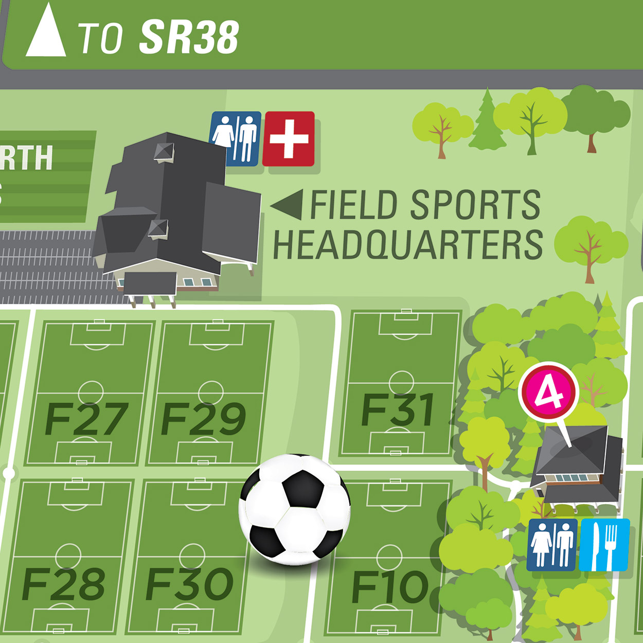
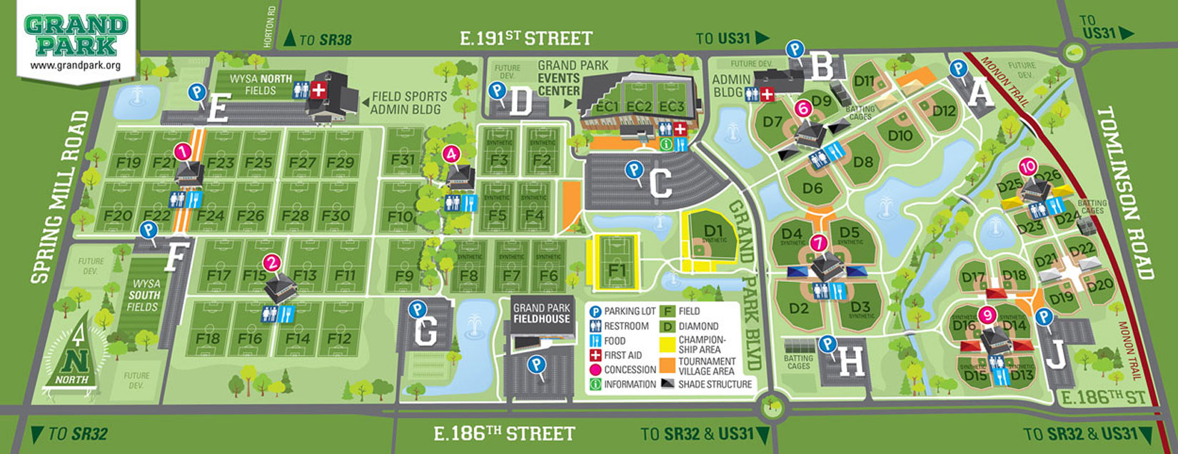
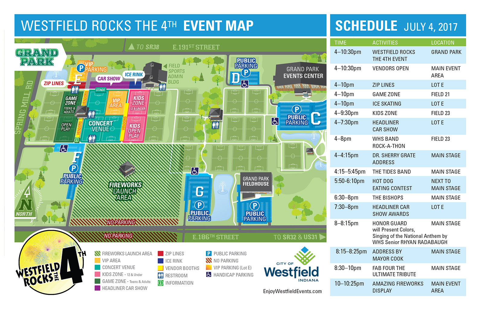
Our illustrated maps are helpful visual resources that are meant to engage the viewer. In this map, we set out to creatively convey the locations of fields, buildings and parking lots in the 400-acre Grand Park in Westfield, IN.
The buildings mimic the actual architecture, further helping viewers understand the lay of the land. This illustrated park map will be presented in print pieces, on-site signage and on the park’s website.
One important result we always intend to accomplish with this type of illustration is to make people smile. There’s a lot of fun to be found at Grand Park and we wanted to reflect that in our colorful, graphic representation.
Do you have a need for a fun way-finding project or a municipal illustrated map? Give us a holler.